MALAYBALAY CITY (MindaNews/28 September) – A city of six clusters and nine zones.
These are the main features of the proposed 2012-2022 Comprehensive Land Use Plan (CLUP) presented during the public hearing conducted by the City Council’s Committee on Human Settlement, Zoning and Land Use last Thursday.
The City Planning and Development Office (CPDO) presented the proposed measure, three years after the expiration of the 2001-2010 CLUP.
Of the nine zones, two are classified as “new important” zones: the “no build zones” and the “restricted development zones,” which were based on the Water Code of the Philippines and the National Disaster Risk Reduction and Management Plan 2011-2028.
While he presented only the highlights of the proposed revised CLUP, Engr. Adrian Gamboa, CPDO officer-in-charge, said “nothing much” has changed between the 2001-2010 CLUP and the proposed version.
Gamboa, who did not distribute copies of the CLUP and the zoning ordinance, said during the public hearing that among the preliminaries to the CLUP revision was the “inclusive vision of Malaybalay City for the next 10 years.”
The CLUP, he said, envisions the city to become “a prime agri-industrial center in Northern Mindanao with vibrant economy where people are God-centered, productive, contented and self-reliant, living in an ecologically balanced environment managed by dynamic, transparent and accountable leaders.”
Gamboa also cited the mission statement of the city government, which is to “provide basic services, encourage business enterprises, promote social justice and ensure effective management and utilization of its natural resources.”
Among the highlights of the CLUP is the grouping of the city’s 46 barangays into six clusters, each with identified “major strategies.”
City proper as center of services
The core of the clusters is the “center of services cluster” to refer to the 11 poblacion barangays and Casisang and Sumpong.
Gamboa said the major strategies of the cluster is to “provide conducive business environment, decent housing for the under privileged and homeless, sports and recreational facilities, and efficient and effective ecological solid waste management.”
Basakan area for food security
The next cluster is the agricultural protection cluster, grouping the 12 basakan or farming barangays.
In this cluster, city planners will use strategies like increased agricultural crop production and productivity in support to food sufficiency and security, provision of adequate production facilities (irrigation and post-harvest), promote organic farming and increase inland fishery production, strengthen production-marketing linkages and provide technical assistance.
Upper Pulangi and Kibalabag watershed
The third group, the forest and water resources protection cluster, includes the eight Upper Pulangi barangays and the villages of Can-ayan, Kibalabag and Manalog.
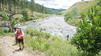
In this area, which covers the Kibalabag watershed, the major source of potable water in the city, the city government intends to apply sustainable management of forest resources, control settlements in protected areas (forests and head water sources), control and limit harvesting of forest natural resources, promote sustainable farming technologies, sustain enforcement of forest protection laws and production laws in upland and marginal areas, and protect and sustain the water quality of the creeks and rivers.
According to the CPDO, about 18 percent of 17,815 hectares is covered with primary forest and 16 percent of 15,453 hectares with secondary forest. The city has a total land area of 108, 259 hectares.
The CPDO noted the need for protection of headwaters with the expansion of communities, deforestation and siltation of intake boxes.
Kitanglad buffer zone
The fourth cluster refers to NIPAS (National Integrated Protected Area System) Buffer and Forest Production Cluster to include the barangays of Dalwangan, Capitan Anghel and Imbayao.
In this area, city planners eye adherence to the buffer or multiple use zone and other regulations of the Protected Area Management Board of ASEAN Heritage Park Mt. Kitanglad Range Natural Park, and the promotion of eco-tourism such as the eco-lodge in Dalwangan for bird watching.
Agri-industrial area
The fifth cluster is the agri-industrial center referring only to the two barangays of Patpat and Kalasungay, host for poultries and piggeries.
The lone strategy indicated for the cluster is to “limit the expansion of poultries and piggeries.”
Agri production area
The last cluster is dubbed the “agricultural production” area referring to Aglayan, Laguitas, San Jose and Magsaysay.
In this sector, the major strategy cited was to stop the expansion of plantation crops especially bananas and pineapple, rehabilitation of creeks and rivers, strengthen production-marketing linkages and provide technical assistance.
Mayor Ignacio Zubiri said during the hearing that the city government will impose the moratorium on agricultural plantation expansion even if it was approved only as a resolution and not as an ordinance.
The CPDO cited a 285 percent increase in the areas planted to banana, pineapple, rubber and sugarcane, from 2,350 hectares in 2000 to 9,052 hectares in 2012.
In contrast, increase in areas planted to rice allotted for food security has increased only 7.13 percent, from 2,797 in 2000 to 2,996 hectares in 2012.
Gamboa also cited the problem of urbanization with the increase in informal settlers along environmentally critical areas, which mean an increase in demand for low-cost housing and basic social services.
In the proposed CLUP, Gamboa cited the need to put up a buffer zone in areas exposed to natural hazards such as flooding and landslide, areas observed to have expanded over the years across clusters.
The proponents have identified areas for settlement expansion in barangays Aglayan and San Jose, and urban expansion in Sumpong and Casisang barangays.
To decongest traffic in the poblacion, the plan is to open a new road connecting Dalwangan and San Jose, but the details were not immediately available during the public hearing.
The CPDO also cited that across all clusters, the city government will ensure public safety and internal security, and develop facilities and utilities geared towards the promotion of green infrastructure to support the social and economic needs of the city.
They also stressed that they plan “to make accessible and affordable quality preventive, promotive, consultative and rehabilitative health services, and increase participation, completion, cohort survival, and achievement rates at all educational levels.”
Zoning ordinance
To give legal support to the plan, the city council also proposed the zoning ordinance to embody the city’s land use policies and establish permitted uses for land covered by the ordinance.
Engr. Jorge Cabanelez, city zoning administrator, presented seven zones with sub-zones in the public hearing, namely the residential, commercial, industrial, institutional, agricultural, protective, and other zones to include parks and recreation and tourist zones.
But Cabanelez said they will also designate “no build zones” or areas prohibited for all kinds of development at specific distances from the banks of streams, creeks, rivers and all other forms of bodies of water.
He added that there will also be “restricted development zones” or areas where all kinds of developments are restricted due to existing, historical and/or perceived physical hazardous conditions like flooding, landslides and earthquakes. (Walter I. Balane/MindaNews)