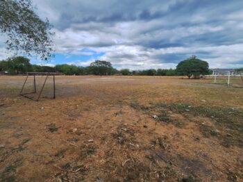
MALAYBALAY CITY (MindaNews / 14 Nov) – In Lumbayao Bridge, one of the bridges crossing Pulangi River, and a critical point to measure water level between Valencia City and the town of San Fernando, the gauge showed 1.08 meters around 2 p.m. on Nov. 11.
At the same time on Nov. 12 – on the day of “Zoraida’s” landfall – personnel at the Provincial Disaster Risk Reduction and Management Council (PDRRMC) operations center found out that the water level rose to 1.92 meters.
Had it continued to rise, the lowland communities in Valencia City would have been alarmed. But two hours later, the stream gauge showed very little increase in the water level at 1.98 meters, before it went down subsequently.
But PDRRMC personnel were not in the riverbank while monitoring this.
In fact, they were in front of a large monitor of a desktop computer browsing the internet to check developments at Lumbayao bridge and several other locations in Bukidnon using the online portal of the Department of Science and Technology’s Project NOAH (Nationwide Operational Assessment of Hazards) at http://www.noah.dost.gov.ph/.
Javlin Cordova, head of PDRRMC’s rescue teams, told MindaNews they had been using the platform to assess danger of flooding from rivers since they covered typhoon Pablo last year.
“So far it had been accurate and it helped us in our work,” he added.
During the strike of super typhoon “Yolanda” and tropical depression “Zoraida,” PDRRMC personnel took turns in virtually monitoring water levels in Bukidnon’s river systems so they could use it in advisories and alerts.
The sharpest increase was observed in Manuto Bridge in Quezon town from 2.59 meters at around 1:50 p.m. on Nov. 11 to 4.47 meters as of 1:30 p.m. the next day. The bridge is near Brgy. Salawagan, where about 44 families from nearby Brgy. Cawayan sought refuge after fleeing their homes to respond to calls for pre-emptive evacuations.
About 360 families from 7 of Bukidnon’s 464 barangays fled when “Zoraida” made landfall at 55 kilometers per hour. Bukidnon and a number other provinces were placed under storm signal no. 1.
“Zoraida” eventually weakened and was identified as a low pressure area (LPA) as it brought only sporadic rains and caused the pre-emptive evacuations and suspension of classes.
Ma. Leah Barquez and other PDRRMC personnel, nevertheless, monitored the situation in 20 towns and two cities from reports of local DRRMC officials and from the NOAH website.
At a section on “weather stations” and “stream gauges” the monitor screen shows figures for the water levels of key river systems in the province where the DOST installed reading stations.
In Malaybalay City, there were monitoring points in the Diversion Bridge in Sumpong for Sawaga River, in Zamboanguita Bridge in the city’s Upper Pulangi area, and in Manupali Bridge, which is at Malaybalay’s boundary with Valencia City.
In Valencia City, the reading stations are at the Lumbayao Bridge in Brgy. Lumbayao and in Valencia Bridge in Batangan. All three measure water level at the Pulangi River.
In northern Bukidnon, there are water level reading stations in Kilabing Spillway and Arch Bridge in Malitbog, Kabula and Bubunawan bridges in Baungon, and Mangima Bridge in Manolo Fortich.
In southern Bukidnon, the reading stations are at Busco and Manuto bridges in Quezon and Maramag Bridge in Maramag town.
Barquez said the availability of online data on water levels helped them in monitoring the danger, especially for residents of flood-prone areas in river banks.
Some of the stations, however, like the Manupali Bridge and the Valencia Bridge, gauges “have no data available” at least as of Nov. 11.
According to its website, the Nationwide Operational Assessment of Hazards (NOAH) program team “will collaborate with government agencies to promote and integrate advanced science and technology to enhance disaster management and prevention capacity of the Philippine government.”
The project includes “the deployment of instruments and state-of-the-art methods to construct high resolution hazard maps that are relevant to the community and local government units; delivery of readily accessible, timely and accurate hazards information through various media and communication platforms; disaster research and development; integration of disaster efforts by the national government, academe and civil society organizations; and application of a bottom-up approach by communities to resilience against disasters”.