DAVAO CITY (MindaNews/26 Nov) – Public Storm Warning Signal number 1 has been raised over 13 provinces in Mindanao and six in the Visayas as Tropical Depression Queenie is expected to make landfall over Surigao del Sur Wednesday afternoon and move across Northern Mindanao in the evening, the weather bureau said.
Flights to and from Siargao Island in Surigao del Norte Wednesday have been canceled.
In its Weather Bulletin number 2 issued at 10:30 a.m. Wednesday, the Philippine Atmospheric Geophysical and Astronomical Services Administration (PAGASA) said Queenie was estimated at 210 km east of Hinatuan, Surigao del Sur, with maximum winds of 45 kph near the center and forecast to move west at 24 kph.
The tropical depression, it added, “has maintained its strength as it continues to move closer toward the eastern section of Mindanao.
” It is expected to make landfall over Surigao del Sur Wednesday afternoon, “traverse the Northern Mindanao area tonight” and by tomorrow morning, is expected to be at 35 km North of Dipolog City.
In Cagayan de Oro City, classes in all pre-school and elementary schools have been suspended effective 11:30 a.m. Wednesday as the City Disaster Risk Reduction Management Office raised the yellow alert, said Teddy Sabugaa, chief of the city’s social services.
The City Disaster Risk Reduction and Management Council (CDRRMC), Sabugaa said, will meet to discuss the contingency plan of evacuating the elderly and the children.
In Surigao City, Vice Mayor Danilo Menor, who is serving as acting mayor, declared suspension of classes in elementary and secondary levels as heavy rains started Tuesday evening.
Frances Semorlan, officer-in-charge of the local PAGASA office, said the amount of rain water recorded at 8 a.m. was 33.8 mm.
She said they alerted the areas in Surigao wherein possible landslides and flashfloods may occur due to heavy rains, noting that the Surigao River has risen to at least one meter and expected to rise some more with the non-stop rains.
Signal No. 1, where 30 to 60 kph winds are expected in at least 36 hours, was raised over 13 of Mindanao’s 27 provinces: Surigao del Norte including Siargao Island; Surigao del Sur, Dinagat Islands province, Agusan del Norte, Agusan del Sur, Davao del Norte, Davao Oriental, Compostella Valley, Camiguin, Misamis Oriental, Misamis Occidental, Bukidnon and Zamboanga del Norte.
In the Visayas, Signal 1 was raised over Southern Leyte, Bohol, Southern Cebu, Southern Negros Oriental, Southern Negros Occidental and Siquijor.
The Low Pressure Area (LPA) was initially estimated at 315 km east of Hinatuan, Surigao Del Sur as of 4 a.m. Wednesday, according to PAGASA’s Weather Bulletin No.
1 issued at 7 a.m.
It said Caraga, Northern Mindanao and the provinces of Leyte and Bohol will experience cloudy skies with moderate to occasionally heavy rain showers and thunderstorms which may trigger flashfloods and landslides, while the regions of Bicol and Davao and the rest of Eastern and Central Visayas will have light to moderate rain showers and thunderstorms.
Weather Bulletin No. 2 noted that Queenie will be at 105 km West of Puerto Princesa by Friday morning and is expected to be outside the Philippine Area of Responsibility (PAR) by Friday evening, and at 710 km West of Puerto Princesa or over the West Philippine Sea by Saturday morning.
It said the estimated rainfall amount within the 300-kilometer diameter of the tropical depression is moderate to heavy, from 7 to 15 mm per hour
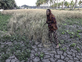
Residents in low-lying and mountainous areas of the provinces under Signal 1 “as well as the rest of Mindanao are alerted against possible flashfloods and landslides.”
The bulletin also said fisherfolk and those with small seacrafts are “advised not to venture out over the eastern seaboard of Visayas and Mindanao.” (MindaNews / with reports from Froilan Gallardo in Cagayan de Oro City and Roel N. Catoto in Surigao City)